Source: NOAA Storm Prediction Center
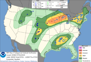
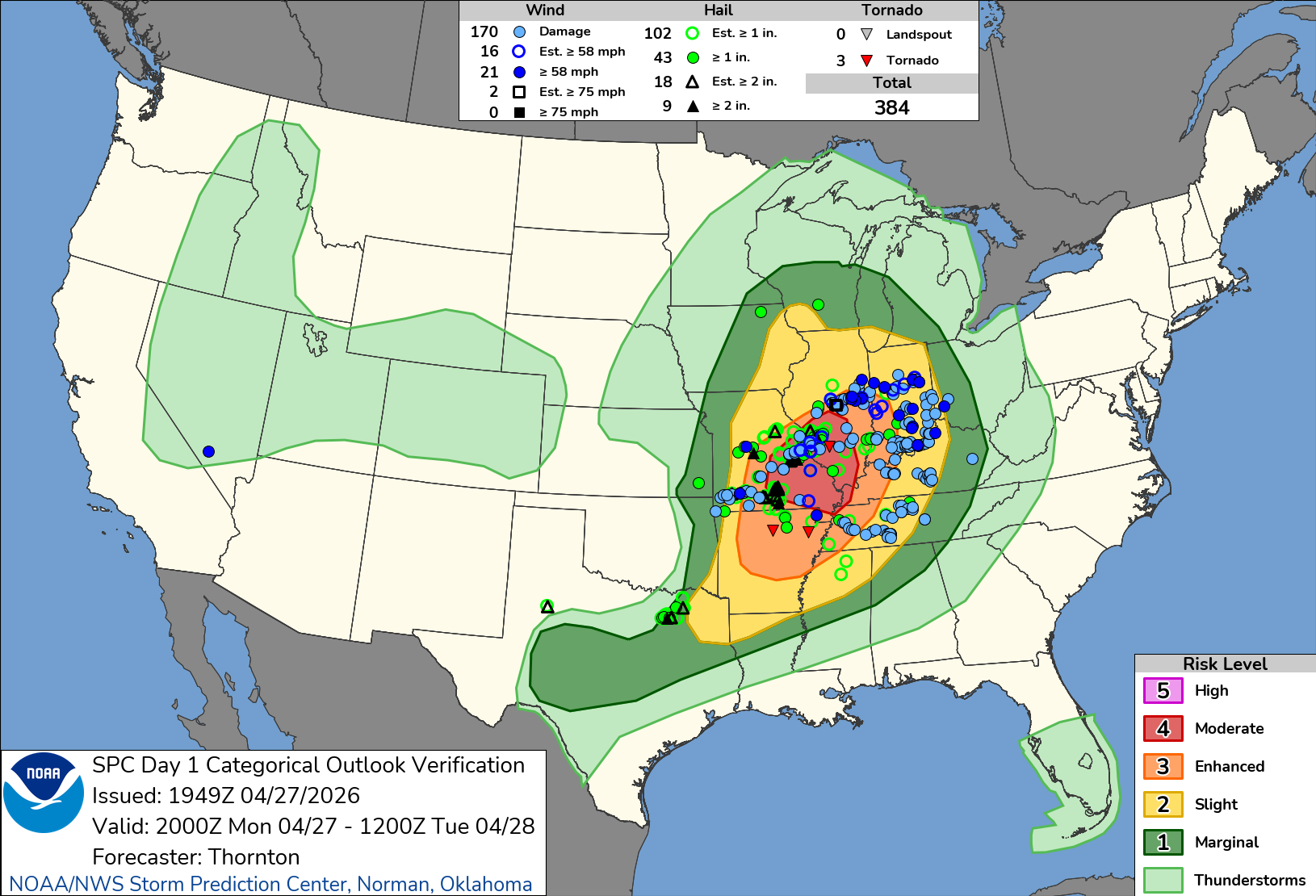
The Storm Prediction Center (SPC) has issued an enhanced risk of severe thunderstorms for parts of the Southern Plains extending into the Lower Mississippi Valley and Mid-South as of April 28, 2026. The forecast, valid from 1300 UTC to 1200 UTC on April 29, indicates that multiple rounds of severe weather are likely, characterized by very large to giant hail, damaging wind gusts, and a few tornadoes. This severe weather threat highlights the importance of preparedness, especially for businesses and municipalities in affected areas.
The SPC’s Day 1 Convective Outlook highlights a significant meteorological setup, with a large-scale upper trough positioned over the Plains and central Canada. An embedded mid-level shortwave trough is expected to move eastward across the southern and central Plains, reaching the lower and mid Mississippi Valleys by evening. As low-level moisture continues to surge northward from Texas into southern Oklahoma, the potential for severe weather increases, particularly as a warm front lifts northward toward a weak surface low over the Ozarks.
As of this morning, a strongly unstable airmass is present across the Southern Plains and the ArkLaTex region. This instability is enhanced by a low-level jet and a retreating warm front. Elevated supercells are already developing across western North Texas, supported by strong deep-layer shear and low-level warm/moist advection. These supercells are expected to pose a significant threat for large to very large hail as they progress east-northeastward throughout the morning.
As the day progresses, the potential for damaging wind threats is likely to materialize, particularly in Arkansas and the Ozarks, as convection crosses the warm front and accesses greater instability. The SPC anticipates additional surface-based convective development near the triple point in north-central Texas toward the ArkLaTex this afternoon, where extreme instability exceeding 4,000 J/kg MLCAPE and robust deep-layer shear will support the formation of multiple intense supercells.
The overall environment is conducive to producing very large hail, with stones measuring between 2 to 4 inches possible with the strongest storms. Although the tornado threat is present, the forecast indicates that low-level shear may not be overly strong, limiting the potential for significant tornado activity.
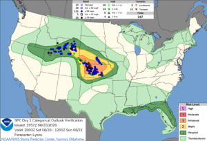
In the wake of morning thunderstorms, the intensity of convection across the Mid-South and southern Appalachians has diminished. However, airmass recovery is expected throughout the day, particularly across the Lower Mississippi Valley and Mid-South. A convectively reinforced front from earlier storms may lift northward, creating conditions favorable for further severe weather development.
The evening forecast suggests that multiple rounds of supercells and multicell clusters are likely, capable of producing large hail, damaging winds, and perhaps a few tornadoes. While less instability is anticipated north of the ongoing convection across the Tennessee Valley, some airmass recovery may still yield a severe weather threat by late afternoon and early evening.
Given these conditions, it is essential for businesses, schools, and municipalities across states like Texas, Oklahoma, Arkansas, and Louisiana to remain vigilant. The potential for severe thunderstorms and tornadoes requires that all facilities ensure they are equipped with appropriate safety measures.
In light of the severe weather forecast, having a reliable tornado shelter is crucial. For businesses and institutions in the affected regions, including Texas and Arkansas, the availability of commercial tornado shelters can be a critical factor in ensuring safety during severe weather events. Facilities should proactively assess their preparedness plans, particularly in areas where severe weather is forecasted.
Utilizing tools like the Storm Planner can assist facility managers in evaluating shelter placement and capacity ahead of severe weather outbreaks. With the potential for large hail and tornadoes, having a designated safe area is essential for protecting employees, students, and the public.
As severe weather systems continue to evolve, businesses should also consider the advantages of implementing a comprehensive emergency preparedness strategy. This includes conducting drills, ensuring that all personnel are aware of safety protocols, and investing in commercial tornado shelters that meet stringent safety standards.
As the risk of severe weather escalates, it is important for construction sites and other facilities to evaluate their shelter capacity. Businesses can take proactive steps by exploring available options for commercial tornado shelters that fit their specific needs. Whether considering long-term purchases or rental shelters, ensuring adequate protection for employees and visitors is crucial.
To assist in this process, businesses can utilize the Storm Planner to determine the most effective shelter locations and capacities. For those interested in seeing how these shelters can be implemented, our photo gallery showcases various shelter designs and setups.
For more information on how to safeguard your facility against severe weather, please contact our team. With the right planning and resources, you can ensure the safety of your workforce and the public during severe weather events. Additionally, you can find more information from the National Weather Service and the Storm Prediction Center.