Issued June 1 at 12:14AM CDT until June 1 at 12:45AM CDT by NWS Wichita KS
Emergency managers confirmed a tornado near Neosho Falls at 12:13 a.m. CDT, and the National Weather Service issued a tornado warning for Allen and Woodson counties in Kansas until 12:45 a.m. CDT. For a facility manager, that means a live severe weather threat was already on the ground, with flying debris, damaging hail, and the need for immediate access to a tornado shelter.
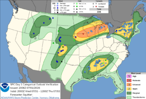
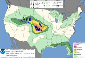
Source: NOAA Storm Prediction Center
The warning came from NWS Wichita KS after a confirmed tornado was located near Neosho Falls, about 9 miles northeast of Yates Center, moving east at 30 mph. The hazard list included damaging tornado conditions and ping pong ball size hail. That combination raises the risk to roofs, windows, vehicles, and exposed equipment across Woodson County and nearby parts of Allen County.
For operations teams, the timing matters. A warning issued just after midnight leaves little margin for staff who may be on site for overnight production, security, maintenance, or utility work. In that setting, a tornado shelter is not a planning concept. It is the difference between controlled movement and improvised response.
The affected corridor included Neosho Falls and Piqua, with the storm expected near Neosho Falls around 12:20 a.m. CDT. In southeast Kansas, nocturnal tornadoes are a recurring concern in spring and early summer. The region often sits under fast-moving supercell threats that can produce brief but destructive tornadoes before sunrise.
This event was not a general outlook. It was a confirmed tornado warning with emergency management verification. That elevates the urgency for any plant, warehouse, school campus, or municipal facility in the path. The National Weather Service uses warnings to signal immediate protective action, not routine monitoring. The National Weather Service and the Storm Prediction Center both emphasize that tornadoes can intensify quickly, especially in organized severe weather setups common across Kansas.
In Allen County and Woodson County, the operational risk extends beyond direct impact. Even a nearby tornado can halt shifts, interrupt power, damage loading areas, and force temporary shutdowns. Tree damage is likely in events like this, and downed limbs can block access roads or emergency routes. For industrial sites, that can delay outbound shipments and complicate post-storm inspections.
Ping pong ball size hail also changes the response profile. Hail can damage skylights, roof membranes, HVAC units, and parked fleets. If a site relies on exterior staging or open yard storage, the exposure rises fast. A tornado shelter should be part of the site’s severe weather plan, especially where overnight staffing or continuous operations reduce reaction time.
June tornado warnings in Kansas often arrive during a period of strong instability and fast storm motion. That pattern can produce short lead times. It also increases the chance that a warning will affect multiple communities in sequence. Neosho Falls, Yates Center, and Piqua all sit within a narrow travel window for a storm moving east at 30 mph.
For a plant manager, that means shelter access must be tied to the actual layout of the site. Employees should not need to cross open yards or large parking lots after a warning is issued. A commercial tornado shelter placed for quick access can reduce exposure during the few minutes available. Our commercial tornado shelters are designed for that kind of operational reality.
Storms like this also create secondary disruption after the warning expires. Crews may need to inspect roofs, doors, and overhead systems before restarting work. If a site has no hardened refuge, the response often becomes more chaotic. That can slow accountability checks and delay the return to production.
For facilities in Allen, Woodson, and surrounding Kansas counties, this warning is a reminder to review shelter access before the next round of severe weather. The event near Neosho Falls showed how quickly a confirmed tornado can move into populated or work-active areas. Facility managers can use our Storm Planner to evaluate shelter placement before the next severe weather outbreak.
That review should account for night shifts, visitor traffic, and areas where staff may be spread across a large property. It should also account for how quickly a warning can escalate from radar concern to confirmed tornado. In this case, emergency management confirmation left little room for delay. A tornado shelter plan needs to match that pace.
For industrial sites, the most useful plans are the ones that reduce decision time. Staff should know where to go, how to get there, and which doors or routes remain open during a warning. That is especially important in rural Kansas, where response times from outside help can be longer and site conditions can change quickly after hail or wind damage.
Industrial and manufacturing leaders in Kansas should treat this warning as a live test of site readiness. If your facility in Allen County, Woodson County, or nearby operations areas still lacks hardened protection, now is the time to review options. You can view available shelter inventory, explore rental options, and use the Storm Planner to map placement against your floor plan and staffing pattern.
If you need help aligning a project with your site conditions, contact our team. You can also review the photo gallery for examples of installed systems. For additional context on service areas and the industries we serve, our site provides more detail for planning teams evaluating severe weather protection after events like the Neosho Falls tornado warning.